Some houses and fish cages can be spotted from above.
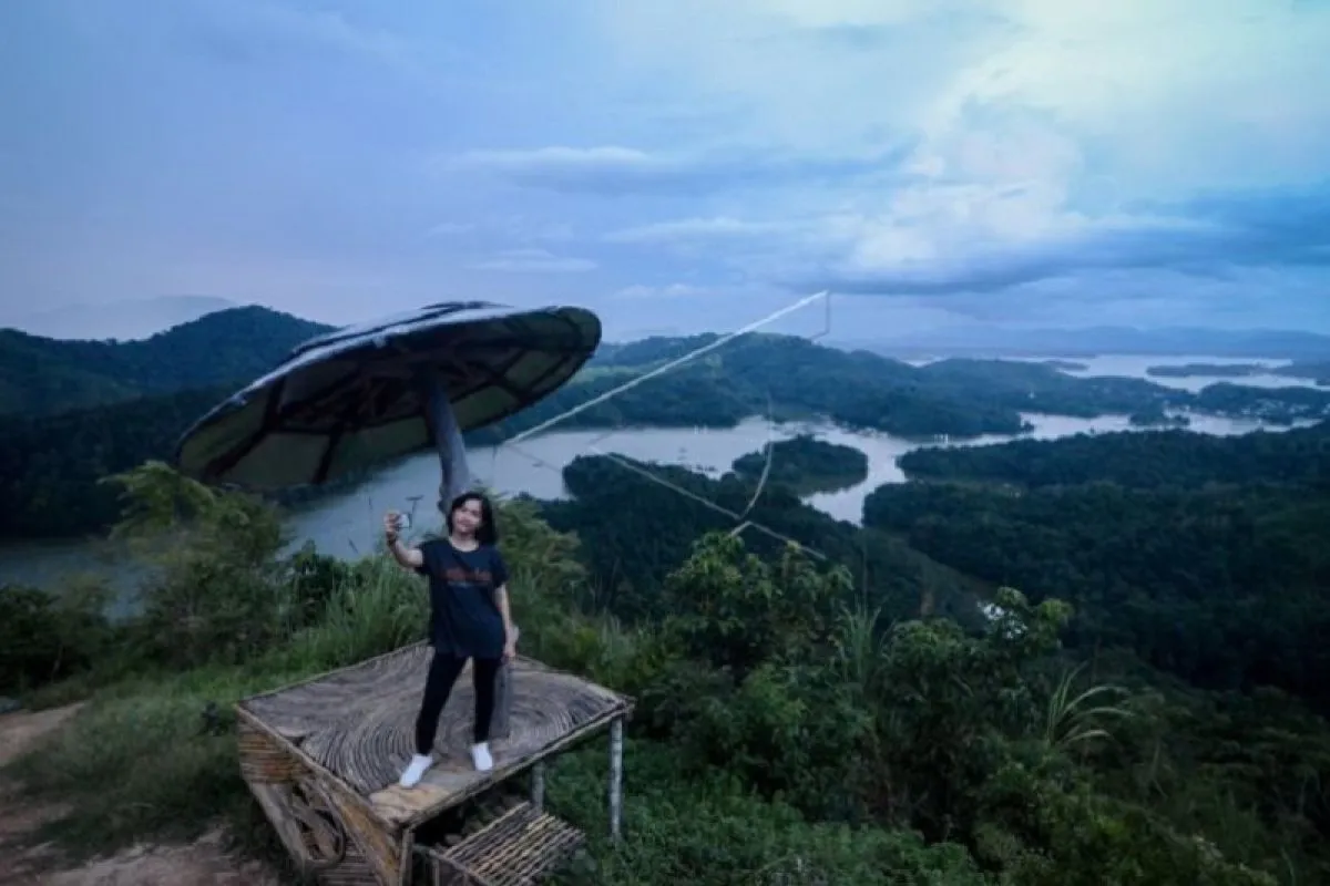
The hill offers a picturesque landscape, with the Meratus Mountains as the backdrop. Several visitors have likened the view to that of the well-known Raja Ampat in West Papua.
In fact, the 400-meter-high Matang Kaladan Hill is located in Banjar District of South Kalimantan. The hill is part of the conservation forest Taman Hutan Rakyat Sultan Adam that covers an area of 112 thousand hectares.
Visitors can choose either the tough or easy way to reach the top of the hill.
The difficult way is quite challenging, as visitors have to take a steep trekking route despite it being equipped with thousands of stone stairs. It takes some 30 minutes to reach the top through this trekking route that offers a scenic panorama.
The easy way can be taken by hiring a motorcycle taxi at Rp20 thousand for a one-way route in which visitors will pass a less steep path covered by paving blocks.
By taking this way, it only takes some 15 minutes to reach the hill top.
In addition to its scenic landscape, Matang Kaladan Hill, which is part of the Meratus Mountains area, has a monumental geological value.
The area, designated as a geosite of the Meratus Geopark, has become popular since 2015.
Development of the tourist destination has been intensified after Meratus Mountains was designated as a national geopark in 2018.
From the ocean floor
Meratus Mountains, spanning some 600 kilometers in South Kalimantan to the north of Central and East Kalimantan, is the oldest expanse of ophiolite or oceanic crust in Indonesia, aged up to 200 million years.
The mountains that have become the backbone of Kalimantan Island were created from ocean subduction, continental collision, and old volcanism.
A geologist at the Pembangunan Nasional University (UPN) Veteran Yogyakarta, Jatmika Setiawan, stated that hundreds of millions of years ago, the area was located six thousand meters deep below the sea surface.
Thereafter, the collision between two continents lifted the oceanic crust up to one thousand meters above the sea level, he stated.
In total, Meratus has 74 geosites spread across nine districts and cities in South Kalimantan.
Matang Kaladan is one of the potential geosites. The hill is part of the metamorphic rocks group composed of schist and serpentinite lithology aged between 100 and 200 million years.
Morphology of the Matang Kaladan geosite is a bumpy hill that formed a lake in its valley.
Strategic Coordinator of the National Geopark Development of the National Development Planning Agency (Bappenas) Togu Pardede noted that the Meratus Geopark holds vast potential.
"In Meratus, there is tremendous potential for geodiversity, biodiversity, and cultural diversity. Everything is interrelated and has a story," he stated.
Pardede stated that from the existing rocks, people can learn about flora, fauna, humans, and culture, all of which are interrelated.
Currently, Indonesia has 19 national geoparks, six of which have been recognized as UNESCO Global Geoparks (UGG).
The six UGG are Mount Batur in Bali, Mount Sewu in Yogyakarta, Mount Rinjani in West Nusa Tenggara, Ciletuh in Sukabumi, Belitung on Bangka Belitung, and Toba Caldera in North Sumatra.
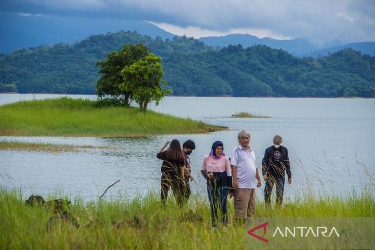
After witnessing the astonishing panorama from the Matang Keladan hill top, visitors can directly head to Kahung Forest. The forest, which in the geological term is known as a serpentinite geoforest, is located in Belangian Village.
The village can be reached by a single-engine boat hired from local people, to cross the 9,730 hectares of Riam Kanan Dam. The dam holds the water from eight rivers flowing down from Meratus Mountains and used by the state electricity company PT PLN for operating a hydro power plant (PLTA).
A neat village housing, with a concrete narrow path, welcomes visitors before entering the Kahung forest.
It takes some 10 minutes to reach the forest by motorcycle taxi from the peer, passing villagers' small rubber plantations, paddy fields, and a small wooden bridge.
Upon entering the forest, a concert of insects and birds chirping create a peaceful ambience. The sound of a black monkey can be heard from a distance.
From here, the journey can be continued on foot, as the authority has offered visitors a narrow path covered by paving block.
Head of the Meratus Geopark Management Agency Nurul Fajar Desira noted that various species of unique and rare flora can be found in the forest, such as the moon orchid (Phalaenopsis amabilis), veiled lady mushroom (Phallus indusiatus), and monkey cups (nepenthes sp).
In addition, one can find honey bears and black monkey in the 500-hectare forest.
The Kahung geoforest comprises quite complex surfaces, with rock types from diorite, basalt, and serpentinite garbo. The forest has a vast array of plant species on account of these complex structures.
Fajar showed a huge benuang laki tree (Duabana Moluccana), forecast to be the biggest tree in the forest.
"It will need some 15 adults to hug this tree," he stated while picturing the diameter of the tree.
From this forest, visitors can continue the trip by boat to Batu Hill, still in the area of Riam Kanan Dam.
Batu Hill is a new tourist destination developed by the South Kalimantan provincial government.
The hill offers a panorama of savanna, with the dam and Meratus Mountains in the backdrop.
Here, visitors can spend the rest of the day with panoramic views of evening twilight interspersed with the scene of vast savannah and yellowish hills.
Related news: Indonesia eyes inclusion of Meratus Mountains into UGGp list: ministry
Related news: The silent rescue of Meratus' rare fruits
Editor: Rahmad Nasution
Copyright © ANTARA 2022


