Even though the Ministry of Environment and Forestry has claimed that the area of forest and land fires has decreased significantly in six years, the target of zero forest and land fires has not been achieved until now.
Indonesia has also simultaneously improved its response system. Currently, the country, which has 22.2 million hectares of peatlands (based on Global Wetlands data accessed on April 16, 2019), is seeing the need for standardization of forest and land fire handling measures, which can serve as a reference for all parties.
Head of the Ministry of Environment and Forestry's Center for Standardization of Instruments for Disaster Resilience and Climate Change, Kirsfianti Linda Ginoga, said the state needs standards that are generally accepted and can serve as a basic reference for business players in the plantation and forestry sector.
The ministry is currently gathering inputs from various relevant parties—from companies, associations, academics, social institutions, to the community—to create a joint guidebook on handling forest and land fires.
During a discussion themed "The role of parties in supporting the application of standard forest and land fire control instruments at the basic level" in Palembang on Tuesday, Ginoga said that standardization will prioritize the norms that apply in the community regarding the use and protection of the environment.
Those norms will be condensed into guidelines that are accepted by all parties so that Indonesia can pursue the 2060 net-zero carbon target.
However, the standards will need to be detailed and dynamic because they will need to be in line with technological advances in the handling of forest and land fires.
For that reason, Ginoga said that the formulation of standards will take a relatively long time. Nevertheless, the ministry is targeting to create the general guidelines this year, she added.
Meanwhile, head of the communication and publication division of Positive Campaign of the Indonesian Palm Oil Association (Gapki) of South Sumatra, Anung Riyanta, said that the government has issued several regulations related to the handling of forest and land fires, including on the standardization of facilities and infrastructure provision and the standardization of permits, among others.
The Regulation of the Minister of Environment and Forestry No. 32 of 2016 concerning forest fire control even explains, in detail, the obligations of facilities and infrastructure that must be prepared by plantation and forestry companies.
Riyanta agreed that the standards must be applicable to all sectors and must be dynamic or follow technological advances.
"Like in the fire towers, there were no drones in the past, but now, all of them (fire towers) are using them (drones). If we want to include it for standardization, we can, but what about other provisions, such as the minimum area of land," he said.
Meanwhile, a fire operation management of Asia Pulp & Paper (APP) Sinar Mas officer in Ogan Komering Ilir (OKI), Mares Prabadi, said the company is now not only providing facilities and infrastructure according to government regulations, but is using the latest technology for handling forest and land fires.
Under the Integrated Fire Management (IFM) strategy, APP Sinar Mas' partner companies are deploying three fixed-wing Flying Dragon UAV drones to monitor hard-to-reach locations up to a radius of 10 kilometers from the monitoring station.
The three drones are being flown daily like patrol helicopters, but are focusing on reaching certain areas that are not monitored by patrol helicopters.
APP Sinar Mas' partner companies are also implementing an early detection strategy by utilizing various resources, including satellites and automated weather system (AWS) equipment, fire towers, monitoring and tactical posts, and fire teams (RPK) for ground and air task forces.
Positive response
Researchers from non-profit organization World Agroforestry (Icraf) have reacted positively to the government's plan to standardize the handling of forest and land fires.
Currently, the world is facing several challenges presented by climate change, such as environmental and food crises. The same holds true for South Sumatra, which has a peat area spanning one million hectares.
Changes, such as a shift in function from protected peat to cultivated peat, will certainly impact the environment.
The shift in function has begun in South Sumatra, so the province is at risk of facing the challenges of climate change due to a decrease in the environment's carrying capacity.
For that reason, Icraf, which is running a number of programs in South Sumatra, such as the "Land4lives" project, is encouraging policymakers to develop a Peat Ecosystem Protection and Management Plan (RPPEG), which is targeted for completion in 2022.
Icraf is also providing inputs to the government, which is currently revising the regional regulation on regional spatial planning.
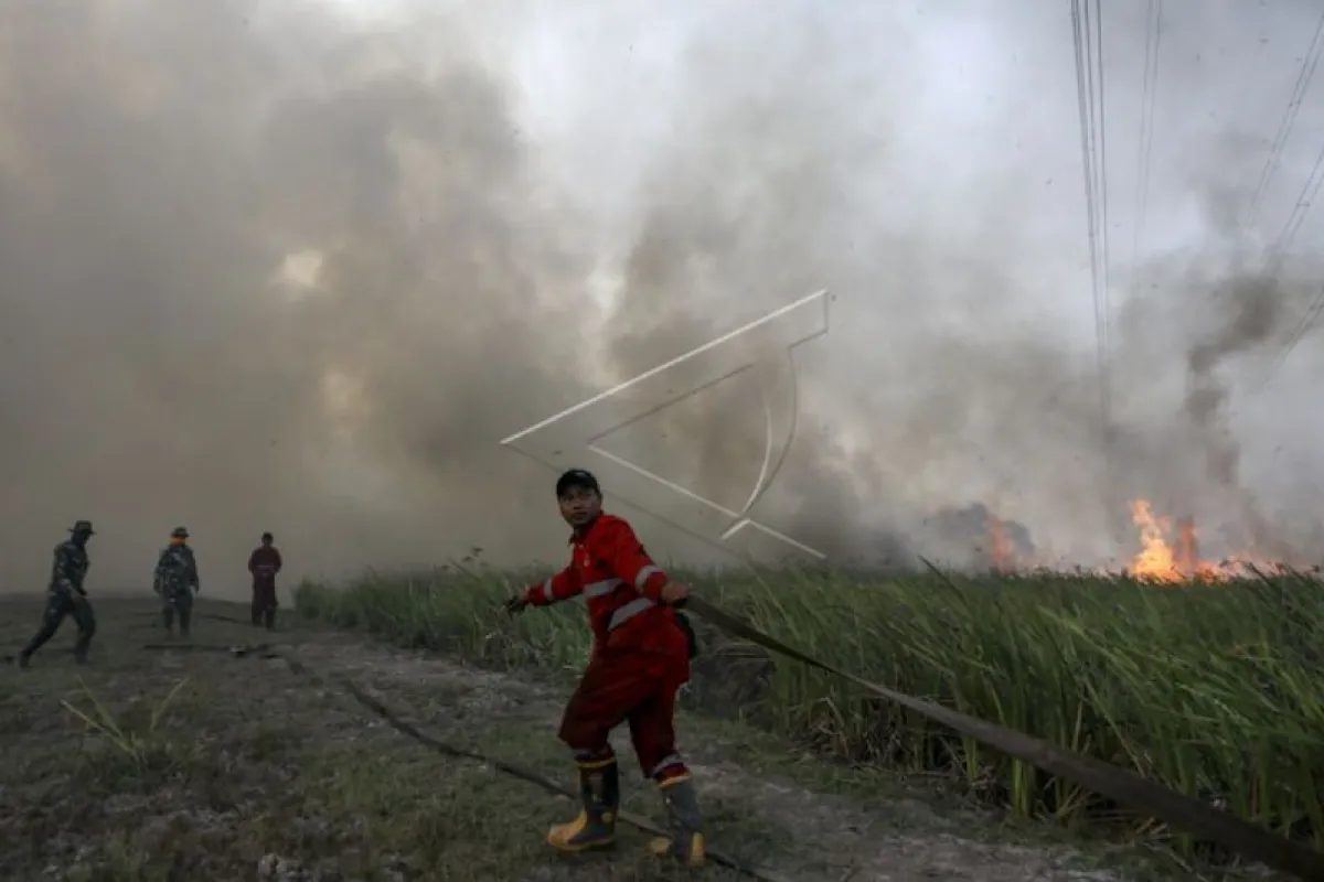
Forest and land fires in Indonesia
According to the Ministry of Environment and Forestry, the area of forest and land fires has decreased significantly in six years since Indonesia has simultaneously improved the response system.
Head of the ministry’s Sub-Directorate for Prevention of Forest and Land Fires, Anis Susanti Aliati, said that in 2014, the burned area reached 1.7 million hectares, while in 2015, it stood at 2.6 million hectares, or an increase of 46.9 percent.
In the next three years, there was a significant decrease in the burned area: the burned area was recorded at 438,363 hectares in 2016, or a decline of 75.3 percent; 165,484 hectares in 2017, or a decrease of 90.7 percent; and 510,564 hectares in 2018, or a drop of 71.3 percent.
However, in 2019, the area of forest and land fires skyrocketed again past the reference figure of 7.2 percent with the total burned area reaching 1.6 million hectares.
In the next two years, the figure contracted again: in 2020, it reached 296,942 hectares, or a decrease of 83.3 percent; and in 2021, it stood at 358,864 hectares, or a decline of 79.8 percent.
"If we want to observe (the figure in) 2022, the data presented is also much better than 2019," she said.
Stakeholders have made many efforts to prevent forest and land fires by reflecting on the forest fire disaster in 2015.
Indonesia has developed a forest and land fire handling strategy by optimizing multiparty collaboration, starting by strengthening coordination from the central to local government levels, controlling forest and land fires using technology such as weather modification technology (WMT) and taking early extinguishing efforts, increasing preparedness, increasing capacity, infrastructure and funding, as well as international cooperation.
Despite the efforts that have been made, Aliati said that forest and land fires remain a threat to Indonesia every dry season because of the peat area of 22.2 million hectares spread over five provinces.
One of the newest challenges that the country is facing is the outbreak of fires in several provinces, namely Aceh, Lampung, Sumber, and West Kalimantan, which have been burning since the beginning of the year, and in mineral land areas.
Therefore, the government has decided to standardize the handling of forest and land fires.
Indonesia's peatlands are believed to be as important as the Amazon forest that spans eight countries in South America. Therefore, the standardization of forest and land fire handling is expected to maintain the great capacity of Indonesia's peatlands.
Related news: South Sumatra BPBD dampening peatlands to prevent wildfires
Related news: South Sumatra BPBD's five water bombers deployed for fire suppression
Editor: Rahmad Nasution
Copyright © ANTARA 2022


