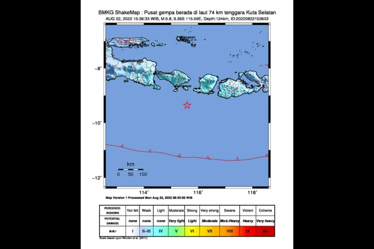
The quake, which hit at 15:36 WIB (West Indonesia Standard Time), was centered 74 kilometers southeast of South Kuta, Bali, at a depth of 124 kilometers, the agency stated.
The BMKG reported that the tremors were also felt in East Java and West Nusa Tenggara.
The tremors were felt by people at Modified Mercalli Intensity (MMI) scale IV in Mataram, West Lombok, Central Lombok, Badung, Denpasar, and Klungkung; at MMI scale III in Buleleng, Karangasem, Gianyar, North Lombok , East Lombok Sumbawa and West Sumbawa, Bima, Tabanan, and Dompu; and at MMI scale II in Jember.
An earthquake of MMI II could be felt by some people and resulted in the hung light articles shaking, while an earthquake of MMI III could be felt indoors akin to the movement of a truck, and an earthquake of MMI IV could be felt by several people within and outside houses, with the windows or doors creaking and audible wall sounds.
Mercalli scale is one of the units to assess the strength of an earthquake, especially in the absence of a seismometer at the site.
No immediate reports were received of any material damage, injuries, or fatalities.
Indonesia sits on the geographically active “Pacific Ring of Fire” and holds some 40 percent of the world's geothermal reserves.
The Ring of Fire, or the Circum-Pacific belt, is the world’s greatest earthquake belt, according to Live Science, owing to fault lines running from Chile to Japan and Southeast Asia.
Related news: BMKG calls for disaster vigilance amid equipment breakdown
Related news: 5.6-magnitude earthquake jolts Aceh Jaya
Translator: Devi Nindy SR, Suharto
Editor: Rahmad Nasution
Copyright © ANTARA 2022


