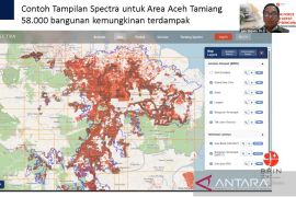
This application is also equipped with a safety feature, which can be used by the fishermen in an emergency situation and show the position of their boats.Jakarta (ANTARA) - The National Research and Innovation Agency (BRIN) has created an innovative application that provides information regarding potential fishing zones (ZPPI) to help fishermen catch fish.
"This app aims to provide certain information on fishing locations to the fishermen based on remote sensing satellite data. This innovation helps fishermen to determine (potential) locations for fishing," Secretary of the Deputy for Research and Innovation Facility at BRIN Lindawati Wardhani said in a statement issued on Thursday.
The application can also show weather conditions, wave height, wind speed, wind direction, the ship's distance, and the location of schools of fish, she added.
By using these features, fishermen can catch fish efficiently and increase their productivity.
"This application is also equipped with safety features that can be used by the fishermen in an emergency situation and show the position of their boats," the BRIN official informed.
As the developer of the application, a researcher from BRIN’s Research Center for Utilization of Remote Sensing, Teguh Prayogo, said the innovation is based on an automatic ZPPI determining method that uses remote sensing data.
He informed that the application uses Sea Surface Temperature (SST) data from the Terra-MODIS, Aqua-MODIS, and SNPP VIIRS satellites as input data.
The application provides information on the whole Indonesian Fisheries Management Area (WPP), which is divided into 24 project areas.
The information on ZPPI is recorded almost real-time and is provided two to six times a day, depending on how many times the satellites pass each WPP project area.
Later, the information will be sent to users according to their fishing operation area via email or File Transfer Protocol (FTP).
However, the researcher said that the application cannot be used freely by the public because it has special regulations to prevent conflicts among fishermen at fishing locations.
Hence, the fishermen who want to use the application need to attend technical guidance on the operation of GPS and fish finder devices first and conduct a trial at a determined ZPPI.
This innovation has been utilized in Indramayu District in West Java Province, Gorontalo City in Gorontalo Province, Demak District in Central Java Province, and Mamuju District in West Sulawesi Province.
Related news: Proud of safeguarding the seas of Maluku, say fishermen
Related news: Indonesia's future economy must be based on space activity: BRIN
Translator: Martha Simanjuntak, Uyu Liman
Editor: Rahmad Nasution
Copyright © ANTARA 2022
