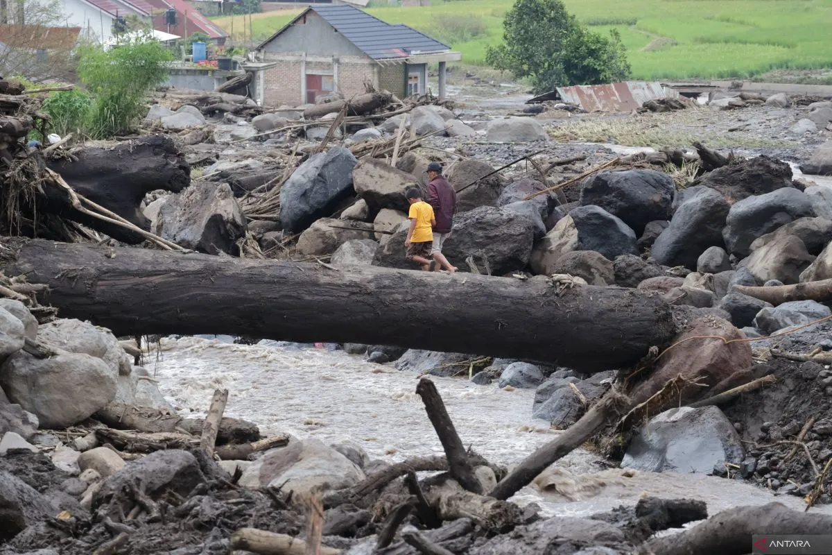
"The land movement is in the form of a flow of debris (flash floods) in the two districts. It was a flow of dilute material in the form of a mixture of materials from deposits of boulders, sand, volcanic ash, and trees," Head of PVMBG, Hendra Gunawan, noted in a statement from his office on Saturday.
Gunawan explained that the flash flood was triggered by prolonged, high-intensity rainfall that hit the river upstream at the peak of Mount Marapi.
In general, the morphology of the disaster location and its surroundings is characterized by plains to medium-to-high undulating hills. Meanwhile, the area affected by flash floods is an alluvial fan plain on the lower slopes of the hills. The height of the disaster location varies between 460 and 1,290 meters above sea level (MDPL), Gunawan remarked.
In terms of geology, the area impacted by flash floods is an alluvial plain made up of eroded and collapsed rocks. The main components of the debris flow material are round angular rocks, wood, and lava blocks, with an andesitic composition measuring 50 to 100 centimeters, he noted.
Based on the geological map of Mount Marapi, Gunawan stated that lava, pyroclastic flows, and tephra products in the form of pyroclastic falls and lava made up the volcanic rock.
Based on PVMBG's investigation, he found that regions affected by cold lava flood have been used for residential areas, agriculture, and public facilities, such as roads, bridges, and other facilities.
"The land at the top is forest, and most of it has been converted into fields and gardens. On the middle slopes, it has been cultivated into rice fields and gardens or residents' fields," he revealed.
Based on the forecast map of land movement in West Sumatra in April, the disaster areas in the two districts have medium to high potential.
"There is a potential for debris flows and ground movements or landslides, especially in areas bordering river valleys, escarpments, road cliffs, or slopes," he noted.
His side reminded the public to be aware of the potential for subsequent flash floods around river flows originating from Mount Marapi.
"During the rainy season or high rainfall intensity, the area around the river that originates at Mount Marapi still has the potential for subsequent flash floods," he emphasized.
Related news: Minister ensures safe, comfortable evacuation for Marapi victims
Related news: Indonesian govt to build 335 homes for victims of cold lava eruption
Related news: Minister Rismaharini revisits cold lava flood-hit Agam District
Translator: Muhammad Zulfikar, Resinta Sulistiyandari
Editor: Azis Kurmala
Copyright © ANTARA 2024


