Head of the Geological Agency, Muhammad Wafid, in a virtual press conference on Tuesday, conveyed that church involvement is crucial since many places of worship were directly affected by Lewotobi's major eruption in late 2024.
"At that time, I coordinated with the bishop since a church was damaged by the eruption. We ensured that the congregation received mitigation information through religious channels," Wafid noted.
He added that the ESDM Minister also established communication with the community to ensure safety and strengthen the psychological well-being of residents in evacuation centers.
During the crisis, his agency expanded the danger zone radius to nine kilometers. These technical recommendations were consistently communicated to local governments and religious institutions to ensure that the public complied with evacuation instructions.
Besides technical coordination, the Geological Agency also supports the provision of basic necessities for residents in evacuation sites, including the construction of groundwater drilling points for daily needs.
Based on data from the National Disaster Mitigation Agency (BNPB), more than two thousand residents in East Flores District have been displaced due to the eruption of Mount Lewotobi Laki-laki since November 2024.
"Coordination is not only with the local government and the Regional Disaster Mitigation Agency (BPBD), but also with religious leaders because they have a strong influence in disseminating information," Wafid explained.
According to him, volcanic disaster mitigation requires an integrated approach with participation from various sectors, ensuring early warning messages are effectively received and acted upon by residents.
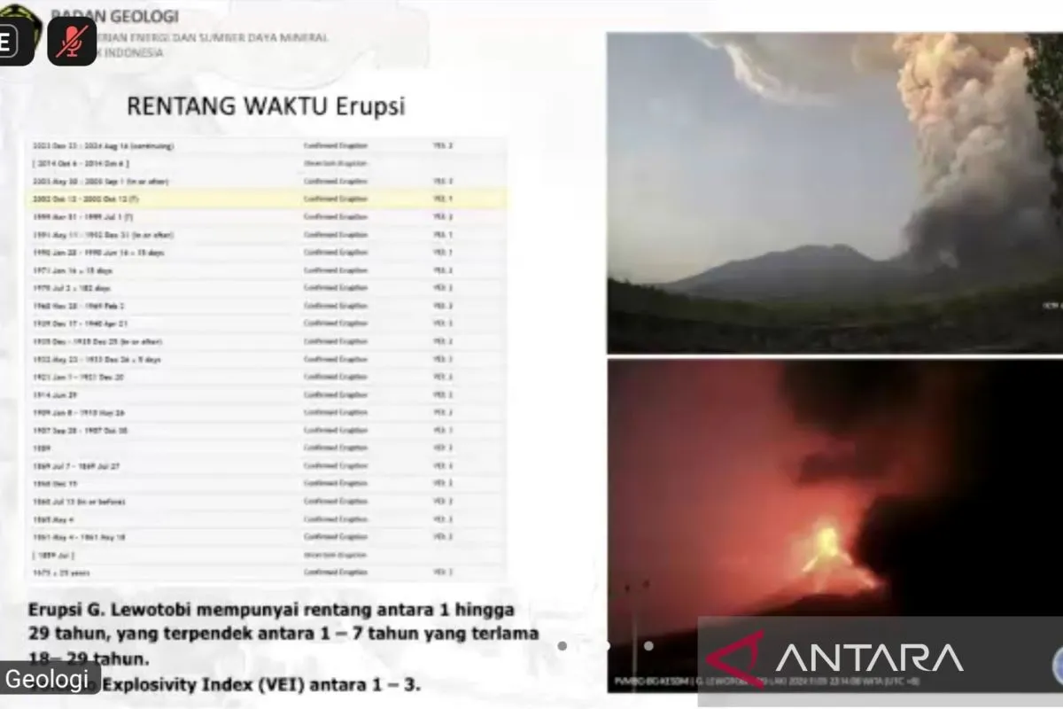
Based on visual and instrumental analysis, Mount Lewotobi Laki-laki's activity remains relatively high, with the last eruption occurring 19 times on Sunday (September 21), during the observation period from 12:00 p.m. to 6:00 p.m. local time at an Alert status.
The public and tourists are advised to avoid activities within a six-kilometer radius of the eruption center, as well as within a seven-kilometer sector in a northwest-northeast direction.
Related news: Indonesia's Mount Lewotobi erupts three times on Sunday
Related news: Sudden eruption likely on Mt Lewotobi, official warns
Translator: Resinta Sulistiyandari
Editor: Arie Novarina
Copyright © ANTARA 2025