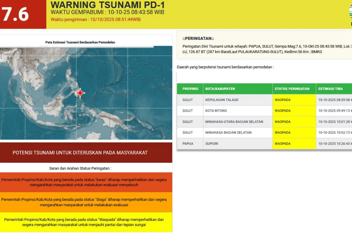
Head of the Jayapura Geophysical Station, Herlambang Hudha, said the tsunami waves were expected to reach northern Papua, including Supiori, at around 12:26 p.m. Eastern Indonesia Time (WIT).
The earthquake occurred at 08:43 a.m. Western Indonesia Time (WIB), with the epicenter located at 7.34 degrees North Latitude and 126.87 degrees East Longitude, approximately 287 kilometers northwest of Karatung Island, North Sulawesi, at a depth of 56 kilometers.
Based on modeling results, the quake had the potential to generate a tsunami.
Therefore, BMKG issued an early tsunami warning for Papua and North Sulawesi. Residents in coastal areas were advised to move away from beaches and riverbanks to avoid possible hazards.
Herlambang emphasized that local authorities should remain alert and promptly guide residents to safe zones. He said swift action from local officials is crucial to minimize potential casualties and damage.
He also reminded the public to stay calm, avoid spreading or believing unverified information, and follow official updates from BMKG.
The agency continues to monitor aftershocks and will provide regular updates as new information becomes available.
Related news: Indonesia maps tsunami causes to improve disaster preparedness
Related news: Cultural approach helps BRIN trace ancient Java tsunamis
Translator: Qadri Pratiwi, Primayanti
Editor: M Razi Rahman
Copyright © ANTARA 2025


