The mountain, located on the border of Lumajang and Malang Districts, is currently at Level III (Alert) status.
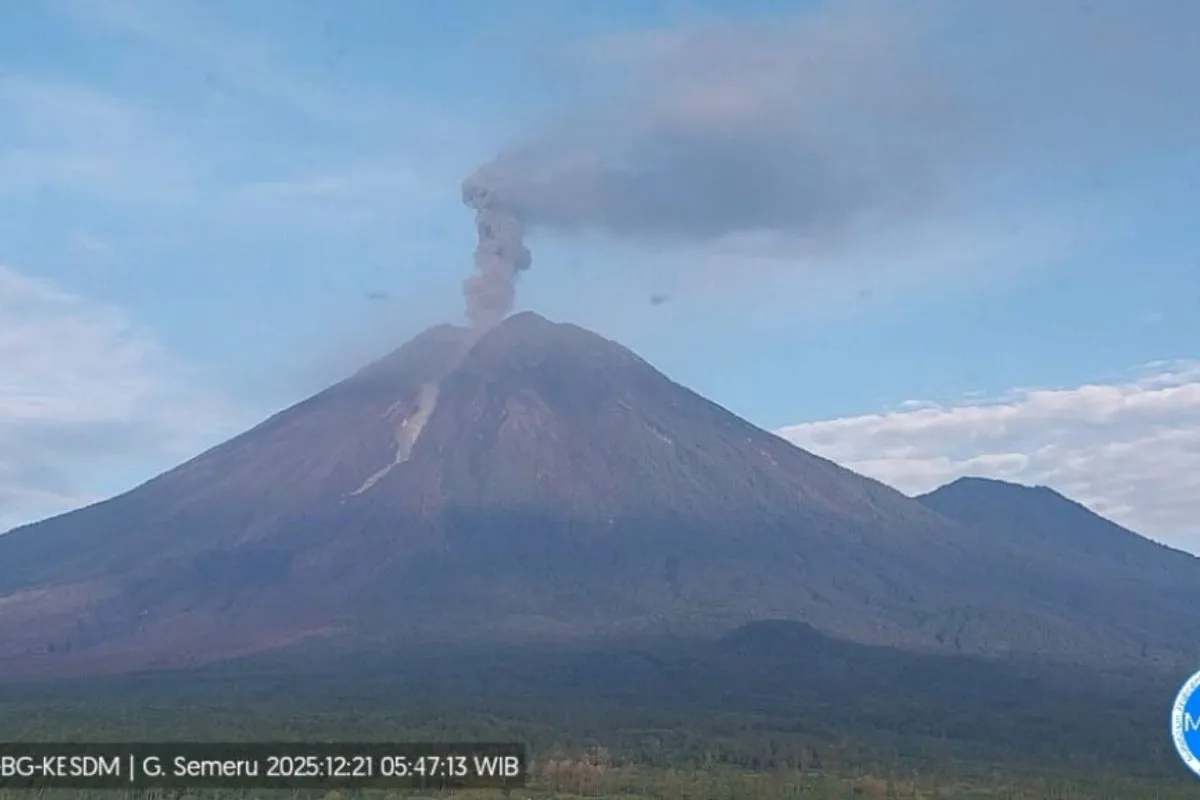
"An eruption occurred on December 21, 2025, at 5:46 a.m. local time, with an observed column height of 1,200 meters above the summit," said Mount Semeru Observation Post Officer, Liswanto, in Lumajang.
The Center for Volcanology and Geological Hazard Mitigation (PVMBG) recommends the public avoid activities in the southeast sector along Besuk Kobokan, within 13 km of the summit.
Beyond that distance, people should stay 500 meters from riverbanks due to potential pyroclastic and lava flows extending up to 17 km.
"The public is also prohibited from activities within a 5 km radius of the crater due to the risk of ejected rocks," Liswanto said.
He urged residents to remain alert for hot clouds, lava flows and lahars along rivers and valleys originating from the summit, including Besuk Kobokan, Besuk Bang, Besuk Kembar, and Besuk Sat.
The volcanic ash column was observed as white, moderate in intensity, and inclined toward the northeast.
"The eruption was recorded on a seismogram with a maximum amplitude of 22 mm and a temporary duration of approximately 2 minutes and 12 seconds," Liswanto said.
Between 12:26 a.m. and 6:00 a.m., eruption heights varied from 500 to 1,200 meters.
Related news: Gov't distributes feed, vitamin to Semeru eruption impacted livestock
Related news: BNPB suggests centralized Semeru evacuation centers modeled on Merapi
Translator: Zumrotun Solichah, Cindy Frishanti Octavia
Editor: Arie Novarina
Copyright © ANTARA 2025


