Acting Head of the Geological Agency, Lana Saria, on Monday, informed that in-depth analysis indicated a fatal combination of fragile ancient geological structures and groundwater saturation that triggered the slope failure in the densely populated area.
"The soil characteristics at the site were like a geological time bomb that finally exploded," she said.
Based on secondary data analysis, Lana explained that the disaster site, located at coordinates 6.796861° South Latitude and 107.539694° East Longitude, rests on the Old Unseparated Volcanic Sediment Formation (QVu) rock unit.
"This unit generally consists of volcanic breccia, tuff, andesite-basalt lava, and pyroclastic material that has undergone intense weathering," she explained.
Advanced weathering of this volcanic rock drastically reduces the soil's shear strength.
Furthermore, the situation is exacerbated by the presence of geological structures in the form of northwest-southeast-trending faults and fractures.
These microscopic cracks act as highways for rainwater to penetrate deep into the soil, creating zones of weakness that are ready to slide millions of tons of soil material at any time, she continued.
The unavoidable triggering factor is heavy rainfall, where intense rainwater infiltration into the weathered soil layer causes a significant increase in pore water pressure.
When this water pressure increases, the soil's cohesion weakens, and when the driving force of the slope exceeds the resisting force, mass movement of soil and rock occurs along the slip plane that develops in the zone of weakness, Lana said.
This explains the technical mechanism behind the landslide's extensive extent.
She added that besides natural factors, human activity has accelerated this process.
Land use dominated by residential and agricultural land use, coupled with the cutting of slopes for roads without adequate drainage systems, has disrupted the stability of the natural slopes, which have reached more than 40 degrees in some areas.
Given that the incident location falls within the Medium Landslide Vulnerability Zone, the technical team issued crucial recommendations that must be followed to prevent further loss of life.
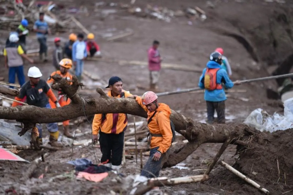
The technical recommendations emphasize that residents near the affected area should immediately evacuate to safer areas since the potential for further landslides remains high, especially due to the already disturbed soil structure.
"Landslide management and the search for missing victims must pay attention to the weather and avoid carrying out activities during or after heavy rain," Lana reminded.
This warning is crucial because further landslides could affect search and rescue (SAR) personnel and volunteers working in the danger zone.
Furthermore, the installation of disaster hazard signs and mitigation outreach are now urgent priorities. The public is urged not only to be aware of rain but also to understand the early signs of landslides in their neighborhoods.
The West Java Regional Disaster Mitigation Agency (BPBD) informed that as a result of the landslide incident on Saturday (January 24), 19 people have been declared dead, 73 people are still missing, 666 people have been displaced, and 51 houses have been severely damaged.
Related news: Navy Chief says 23 Marines among victims of Cisarua landslide
Related news: SAR team recovers 29 bodies from Cisarua landslide, sent to DVI
Related news: Ministry sues six companies over worsening North Sumatra disaster
Translator: Ricky Prayoga, Resinta Sulistiyandari
Editor: Azis Kurmala
Copyright © ANTARA 2026


