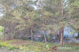
The province`s coastlines used to be covered by a total of 2,654 hectares of forest but continuous trampling and settlements construction over the years had destroyed 91.41 percent of the plant life, Berlian, a member of the Bengkulu branch of the Indonesian Forum for the Environment (Walhi), said here Thursday.
"As a result of the relentless exploitation of coastal areas, only 8.59 percent of Bengkulu`s coastal areas is now still covered by forest. This will become a prolonged threat of disaster for Bengkulu," Berlian said.
He said, the data on the coastal forest on the west coast of Bengkulu, published by the Muko Muko district`s forestry office noted Muko Muko nature reserve I registers 86 has an area of 230 hectares and Muko Muko nature reserve II registers 86A has an area of 103.50 hectares.
Meanwhile, Air Hitam Nature Park registers 102 covering 433 hectares, Air Rami nature reserve I register 87 has an area of 233 hectares, Air Rami II registers 87A covering 38.9 hectares and Air Sebelat nature reserve registers 89 covering 89 hectares.
"The results of our investigation, specifically in Muko Muko district, Muko Muko I and II nature reserves had been lost due to abrasion because of wild encroachment," Barlian explained.
Meanwhile, in Bengkulu city, the coastal forest covers found in Pantai Panjang nature tourism park and Baai Island registers 91 covering 987.20 hectares.
The condition of the coastal forests is still relatively good, although threatened by sand encroachment and exploitation in the coastal area of Baai island port.
While in the coastal area of Seluma district, there are Pasar Ngalam nature reserves registers 92 area of 256.92 hectares, Pasar Seluma registers 93 covering 159 hectares and Air Alas nature reserves register 103 covering 59.5 hectares.
"The regions in Seluma west coast that is currently exploiting of its iron ore sand, makes the threat to coastal forests higher," Barlian added.
The condition of coastal forest area that is still relatively well contained in Kaur district namely in Wayhawang nature tourism park register 95 covering 64 hectares.
The total forest area which is a coastal conservation area is 2,654 hectares with the general conditions of damage due to the transfer function for the settlement, mineral excavation, plantations and public facilities construction as well as damaged by abrasion.
With the condition, Bengkulu areas prone earthquake and tsunami risk is higher because there is no longer the fortress of coastal forests, Barlian added.
"The rate of abrasion is also higher, like in Muko Muko district that reaches 1.5 meters per year occurred since 2007," he said.
(Uu.KR-LWA/HAJM/F001)
Editor: Priyambodo RH
Copyright © ANTARA 2011


