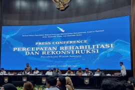
Research and Technology Minister Suharna Surapranata at the legislative building here on Tuesday said he was grateful that the bill on GI, proposed by the government to the DPR on February 16, 2011, was approved to become law.
"The presence of Geospatial Information law will guarantee the rights of all Indonesian people to obtain information to improve their private quality and social environment as being regulated in article 28F of 1945 Constitution," Suharna said.
Such a law will also be dedicated to support the management of natural resources and other resources in the country for the prosperity of all people of Indonesia today and in the future.
The law on GI contains an important principle that the basic geospatial information (IGD) and thematic geospatial information (IGT) organized by government agencies are open.
According to the research and technology minister, the Geospatial Information law was in line with Law No.14/2008 on public information openness.
It means that the Indonesian citizens can access and obtain IGD and IGT and to use them in various aspects of life.
IGD in the law on IG is made up of geodesic control network horizontal and vertical position reference, and basic map for various important elements for geometric reference in the sea and coastal land.
"We hope the presence of the Geospatial Information law will ensure easy access to obtain systematic and accurate information which can be accounted for," Suharna said.
He added that with such a law, public services and policies especially related to earth spatial policy would be more accurate and reliable.
(Uu.O001/HAJM/F001)
Editor: Priyambodo RH
Copyright © ANTARA 2011


