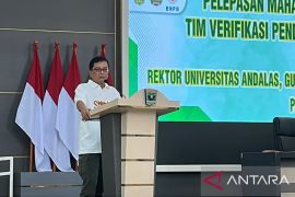
"It needs to create (a maritime map), as we have experienced that the person whose ship had crashed into the reef in Raja Ampat in West Papua Province also blamed us for not having (a sea map)," he noted while giving a public lecture at the Graha Sanusi Hardjadinata Building, Padjadjaran University, in Bandung City, West Java Province, Friday.
He asserted that the government is working on creating a new sea map, and it was expected to be completed shortly.
"I think we are working now to make a map of the entire maritime territory of Indonesia," he remarked.
As the biggest archipelagic nation in the world, 79 percent of Indonesias territory is covered by sea, and the remaining region is covered by land.
"We realize that the power of our maritime law is limited. We have no sea map yet including that showing the topography. In fact, an agency under the Coordinating Ministry for Maritime Affairs is tasked with preparing the map of Indonesias seas," he pointed out.
Pandjaitan stated that Indonesias economic potential in the maritime field is high, pegged at Rp1.33 trillion annually.
Hence, his party has invited academicians, including those from the Padjajaran University, to work along with the government to conduct a comprehensive study on the maritime economy of Indonesia.
"You have to conduct a comprehensive study. I am saddened if our maritime regulations are not strong," he added.(*)
Editor: Heru Purwanto
Copyright © ANTARA 2017


