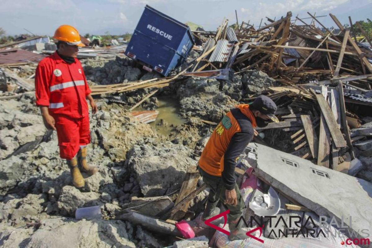
The world's largest archipelagic nation comprising over 17 thousand islands is located in the Pacific Ring of Fire, a horseshoe-shaped region of converging tectonic plates and several volcanoes.
The country has four disaster clusters: geology and volcanology (volcanic eruptions, earthquakes, and tsunamis); hydro-meteorology I (forest fires and drought), hydro-meteorology II (flash floods, landslides, and coastal abrasion); and non-natural disasters (waste, epidemics, and technological failures).
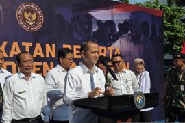
"In fact, outsiders call Indonesia a 'disaster supermarket' because of our complex demographic contours. We are one of the 35 countries, with the highest level of potential disaster risks in the world according to the World Bank's indicators," National Disaster Management Agency (BNPB) Head Lt Gen. Doni Monardo stated on May 6, 2021, while speaking at an online seminar on "The Importance of Building Disaster Competencies and Skills in Indonesia" organized by the School of Environmental Sciences (SIL) of the University of Indonesia (UI).
During the January-April 14, 2021, period, a total of 1,118 natural disasters had struck various parts of Indonesia, according to the BNPB data.
The natural disasters comprised 473 occurrences of floods, 305 whirlwinds, 217 landslides, 17 earthquakes, 90 forest and land fires, one incident of drought, and 15 high tides and abrasions. On April 13, 2021, the government declared the spread of COVID-19 as a non-natural national disaster.
At least 472 people lost their lives, 60 people went missing, and 12,872 others sustained injuries in the disasters. The natural disasters forced 4,901,400 people to flee their homes and damaged 137,719 homes, with 24,987 houses sustaining severe damage, 25,926 houses experiencing moderate damage, and 86,806 houses suffering light damage. A total of 2,547 public facilities were also damaged, comprising 1,316 educational facilities, 926 places of worship, 305 health facilities, 402 offices, and 297 bridges, according to the BNPB.
Most of the natural disasters were reported in West Java, reaching 284; followed by 157 in East Java; 156 in Central Java; and 76 in Aceh.
Finance Minister Sri Mulyani Indrawati earlier stated that disasters had led to losses amounting to Rp28.8 trillion annually.
Indonesians earlier paid no attention to weather forecasts. However, since the frequency of natural disasters, such as cyclones, whirlwinds, and tornadoes, had been increasing, several people are currently left with no choice but to follow the weather forecast news.
Hence, President Joko Widodo (Jokowi) has sought easier public access to weather forecast and warnings of the Meteorology, Climatology and Geophysics Agency (BMKG) to raise awareness on potential disasters.
At an online limited meeting on natural disasters in West Nusa Tenggara and East Nusa Tenggara from the Merdeka Palace, Jakarta, recently, Jokowi remarked that all regional leaders and the public should be able to access and monitor the weather forecast issued by the BMKG.
"They should be able to receive information. Thus, people could increase awareness to address potential risks of strong winds, flooding, flash floods, and landslides," he remarked.
The head of state also urged the agency to intensify warnings on extreme weather triggered by the tropical cyclone Seroja.
Jokowi ordered the public works and public housing minister to expedite renovation of damaged infrastructure after the cyclone hit West Nusa Tenggara and East Nusa Tenggara.
"Restore electricity lines, telecommunications, internet lines, and also the distribution of logistics and fuel oil, so that humanitarian aid can be distributed soon to victims of the disaster," Jokowi emphasized.
President Jokowi has called on the public to adopt precautionary measures against further risk of extreme weather in several parts of the country.
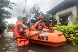
Tropical cyclone Seroja hit the Indonesian province of East Nusa Tenggara on April 5, 2021, after midnight, triggering flash floods and landslides that claimed the lives of at least 128 people.
The tropical cyclone has affected the provincial capital of Kupang and the districts of East Flore, Malaka, Lembata, Ngada, West Sumba, East Sumba, Rote Ndao, and Alor.
On April 3, BMKG Head Dwikorita Karnawati had issued a warning to the people of East Nusa Tenggara of coastal flooding forecast to occur in parts of the province, including on the north coast of Flores Island and Alor Island, the north or south coast of Timor Island and Rote Island
In the meantime, the government has continued to intensify precautionary measures to lower the impacts of any potential disaster and boost public awareness of the potential for natural disasters in Indonesia.
Various programs are formulated by incorporating local wisdom and involving the community to create a sense of adoration among members of the public and help them to gain a better understanding of the potential of the environment around them. Disaster mitigation efforts are also being conducted by the government through educational programs. Through collaboration with various stakeholders, programs formulated by the government will be sustainable and gain greater acceptability among members of the community.
To prevent forest fires, for instance, a public welfare approach has also been adopted by preparing long-term programs to develop the local economic potentials and process forest and land products to have added value.
The BMKG has opened an Earthquake Field School and a Fisherman Weather Field School to create disaster socialization agencies. It has also built and continues to develop an early warning system to bolster the effectiveness and efficacy of disaster mitigation in Indonesia.
Moreover, the BNPB has called for planting millions of tree seedlings across Indonesia’s coastal areas to mitigate impacts of disasters on vegetation.
"Today, 3,313 tree seedlings have been planted, and this figure is certainly not sufficient because we still need millions of trees to be planted throughout our coastal areas," Monardo remarked while witnessing a tree planting event in Cilacap in April 2021.
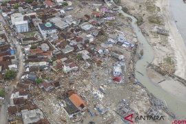
Bunton Village in Cilacap was selected as the location for planting tree seedlings since the village was hit by an earthquake and tsunami in 2006 originating from the south of Pangandaran in West Java. In fact, several villages along the Cilacap coast were affected by the tsunami in 2006, in which 165 people lost their lives.
"It turns out that in 1921, an earthquake and tsunami had also hit the Cilacap area. What does it mean? It means that the earthquake and tsunami are recurring events. In a period of tens and perhaps hundreds of years to come, these events are likely to happen again," he cautioned.
Hence, vegetation-based mitigation is one of BNPB's efforts to reduce the disaster risk in accordance with President Joko Widodo's orders to prevent people from falling victims when a disaster strikes.
"We all have an obligation to protect our coastal areas, both from abrasion and the threat of a tsunami, especially beaches that are at risk of earthquakes and tsunamis, especially on the western coast along the island of Sumatra and the southern part of Java Island, as well as several other areas in Sulawesi and Maluku, North Maluku, and northern Papua," the agency’s head emphasized.
For mitigation efforts, Monardo noted that the types of vegetation suitable for coastal areas are cypress, sea ketapang, pule, palaka, and waru as well as several other types of plants that can survive for prolonged periods of time or for hundreds of years.
Related news: BNPB records 1,118 natural disasters until April 14
Related news: NTT flooding death toll climbs to 128, as 72 untraceable
EDITED BY INE
Editor: Suharto
Copyright © ANTARA 2021
