The quake's epicenter was located at 8.13 degrees southern latitude and 116.94 degrees eastern longitude, at a depth of 10 kilometers, according to the Meteorology, Climatology, and Geophysics Agency (BMKG).
The tremors could be felt by residents in the areas of North Lombok, East Lombok, and Sumbawa at III MMI (modified mercalli intensity).
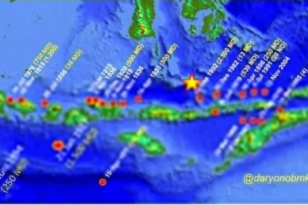
Earthquakes regularly strike various parts of Indonesia due to the fact that the country lies on the Circum-Pacific Belt, also known as the Ring of Fire, where several tectonic plates meet and cause frequent volcanic and seismic activities.
Related news: Selayar Islands declares emergency status after 7.4 M earthquake
Two of the deadliest earthquakes in Indonesia that occurred over the past few years were the ones that hit several areas of West Nusa Tenggara and Central Sulawesi Provinces.
On August 5, 2018, a magnitude 7.0 earthquake rocked Mataram, the capital city of West Nusa Tenggara Province, killing at least 555 people and causing injuries to 829 others.
According to the National Disaster Mitigation Agency (BNPB), the majority of the fatalities were residents of North Lombok District areas, due to their close proximity to the strong earthquake's epicenter. The repeated earthquakes also damaged 23,098 houses and forced 134,236 people to be displaced.
Meanwhile, on September 28, 2018, a 7.4-magnitude earthquake that was followed by a tsunami hit the areas of Palu City and the districts of Donggala, Paringi Moutong, and Sigi in Central Sulawesi, claiming 2,102 lives.
Related news: 267 aftershocks hit Flores Sea as of Wednesday morning: BMKG
The earthquake also injured 4,612 people and rendered 680 others missing. It also damaged 68,451 houses and displaced 78,994 people.
This year, a deadly earthquake that rattled Indonesia occurred in West Sulawesi Province on January 15.
The 6.2-magnitude earthquake, ensued by several aftershocks, jolted the districts of Mamuju and Majene, claiming more than 100 lives and destroying several buildings.
Related news: Fault activity causal to Flores Sea earthquake: BMKG
Apart from those above earthquakes, Indonesia had ever experienced the most catastrophic earthquake and tsunami in Aceh Province on the northernmost tip of Sumatra Island on December 26, 2004.
The catastrophe that also affected certain coastal areas in countries, such as Thailand, Sri Lanka, and India, reportedly killed some 230 thousand people.
Related news: 5,511 families affected by Flores Sea quake: Selayar BPBD
Related news: Some 346 houses destroyed, 770 evacuated after earthquake hit NTT
Translator: Rangga PAJ, Rahmad Nasution
Editor: Fardah Assegaf
Copyright © ANTARA 2021


