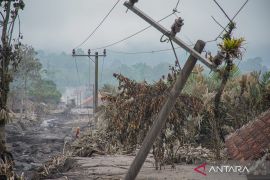
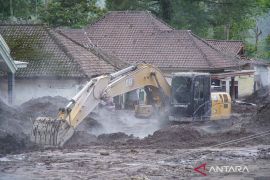
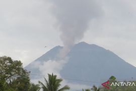
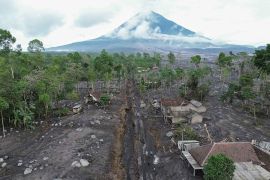
They are also not allowed to enter the area within a five-km radius from the crater to avoid the likely danger of incandescent stones.Jakarta (ANTARA) - The Geological Agency of the Energy and Mineral Resources Ministry raised the status of Mount Semeru in Lumajang District, East Java Province, from Level 2 (Watch) to Level 3 (Advisory).
"It has been raised since December 16, 2021, at 11 p.m. Western Indonesia Standard Time (WIB)," the agency's head, Eko Budi Lelono, said in a statement here on Friday.
The status was raised on account of the volcano's high activity as well as an increase in the sliding distance of the pyroclastic flow and lava avalanches.
The agency head has urged the public to not conduct any activities in the southeast sector along Besuk Kobokan River at a distance of 13 kilometers (km) from the mountain's peak.
Related news: VP urges East Java to conceive Semeru victims' relocation plan
In addition, the community is urged to avoid the Besuk Kobokan riverbank at a distance of 500 meters, as it is potentially affected by extended pyroclastic flow and lava avalanches up to a distance of 17 km from the peak.
"They are also not allowed to enter the area within a five-km radius from the crater to avoid the potential danger of incandescent stones," Lelono remarked.
On Thursday, a pyroclastic flow slid as far as 4.5 km from Mount Semeru’s crater at 9:01 a.m. WIB, with a maximum amplitude of 25 millimeters (mm) and a duration of 912 seconds.
At 9:30 a.m. WIB, a subsequent pyroclastic flow, with a maximum amplitude of 17 mm was recorded for a duration of 395 seconds. However, its distance could not be observed due to the fog.
In addition, another pyroclastic flow was emitted at 15:42 WIB, sliding a distance as far as 4.5 km from the peak, with a maximum amplitude of 20 mm and a duration of 400 seconds.
Related news: Mount Semeru emits pyroclastic flow extending 4.5 km on Thursday
Meanwhile, regarding seismic activities, the shocks mostly comprised eruption quakes, volcanic tremors, and avalanches vibrations.
The number of avalanches had increased to 15-73 events per day in the last three days. Earlier, the number of avalanches averaged eight per day since December 1, 2021.
"Meanwhile, deep volcanic earthquakes and harmonic tremors occurred in insignificant amounts," the agency head remarked.
Related news: BNPB to ensure emergency response service ready at Mount Semeru
Pyroclastic flows are likely to occur since lava deposits travelled as far as two km from the eruption center. Moreover, the lava flow is still unstable and can likely cause avalanches.
"In addition, due to the high intensity of rainfall received on Mount Semeru, there is a high likelihood of lahars -- pyroclastic mudflows -- occurring," Lelono added.
Meanwhile, the Meteorology, Climatology, and Geophysics Agency (BMKG) has forecast rainy season for the next three months.
Secondary explosions may also likely occur along the river if the hot eruption materials enter the water.
Related news: VP Ma'ruf Amin reviews Mt. Semeru refugees
Related news: Gov't to offer Rp1-billion assistance to Mount Semeru eruption victims
Translator: Sugiharto Purnama, Uyu Liman
Editor: Fardah Assegaf
Copyright © ANTARA 2021

