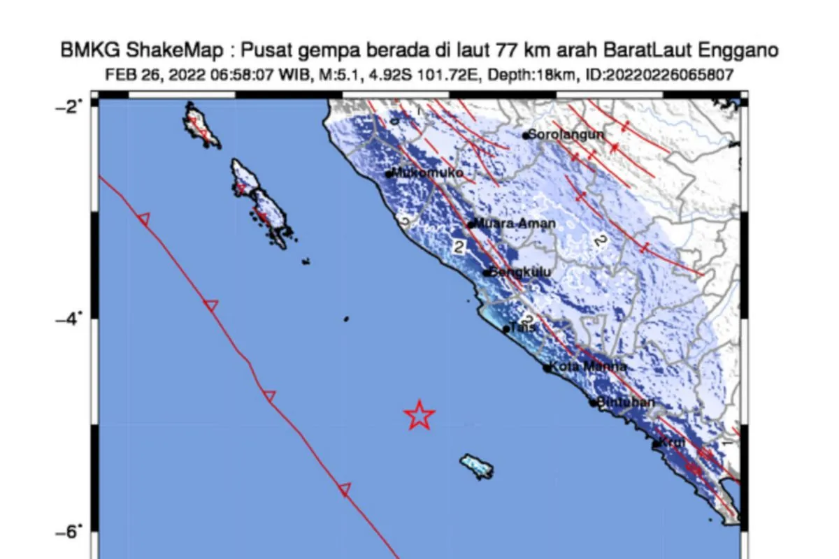
The epicenter of the earthquake, which struck at 6:58 a.m. local time, was located at sea, 77 kilometers northwest of Enggano, at a depth of 18 kilometers, the agency notified on its official website.
The earthquake was felt in the provincial capital of Bengkulu at Modified Mercalli Intensity (MMI) scale II-III, the BMKG reported.
An earthquake of MMI II was felt by some people and resulted in the hung light articles shaking, while a quake of MMI III could be felt indoors akin to the movement of a truck.
According to the agency, Mercalli scale is one of the units to assess the strength of an earthquake, especially in the absence of a seismometer at the site.
No immediate reports were received of any material damage, injuries, or fatalities.
A quake of magnitude 5.1 can cause considerable damage to land.
Bengkulu's earthquake came a day after a 6.1-magnitude earthquake hit the neighboring province of West Sumatra on Friday morning.
Related news: Police Chief urges ranks to immediately assist Pasaman quake victims
Two people died while 20 were injured in the quake that struck West Sumatra, according to Head of the National Disaster Mitigation Agency (BNPB) Lieutenant General Suharyanto.
Indonesia sits on the geographically active “Pacific Ring of Fire” and holds some 40 percent of the world's geothermal reserves.
The Ring of Fire, or the Circum-Pacific belt, is the world’s greatest earthquake belt, according to Live Science, owing to fault lines running from Chile to Japan and Southeast Asia.
Related news: 6.1-Magnitude quake in West Sumatra felled several hundred houses
Translator: Asep Firmansyah, Suharto
Editor: Rahmad Nasution
Copyright © ANTARA 2022


