"Stay alert in the affected areas," BMKG Deputy for Meteorology Guswanto confirmed here on Wednesday.
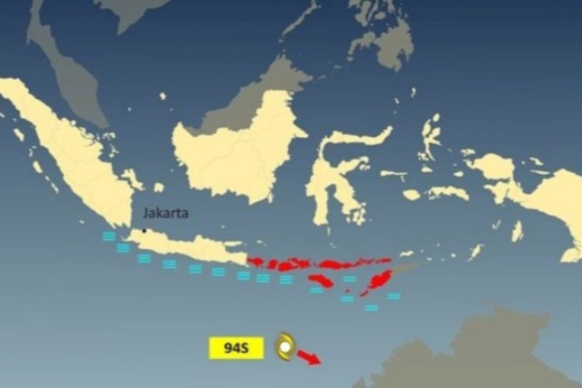
Guswanto noted that the seeds of tropical cyclone 94S were still being observed in the Indian Ocean in the southern part of NTB, around 12.1 degrees south latitude and 115.6 degrees east longitude.
He explained that seeds of the tropical cyclone 94S had a maximum wind speed of 20 knots and minimum air pressure of 1,005 millibars (mb), moving southeastward, away from the Indonesian territory.
"The potential for tropical cyclone 94S is estimated to grow into a tropical cyclone in the next 24 hours, with a low category," he remarked.
Guswanto said the areas affected by the 94S tropical cyclone seeds were expected to experience moderate to heavy rains, with several impacted regions, including Bali, NTB, and East Nusa Tenggara.
Another impact of the cyclone seeds is sea waves reaching up to four meters in height.
High waves of around 1.5-2.5 meters can potentially arise in the Sawu Sea, the southern part of the Sape Strait, southern waters of Sumba Island, and southern Indian Ocean of East Nusa Tenggara.
Higher waves of 2.5-4 meters are also likely to occur in the southern waters of Java Island to Sumbawa Island, southern Bali Strait, southern Lombok Strait, southern Alas Strait, and southern Indian Ocean of Banten to NTB.
Related news: Tropical cyclone Nalgae moving away from Indonesia: BMKG
Related news: Two potential tropical cyclones may cause high sea waves: BMKG
Translator: Katriana
Editor: Rahmad Nasution
Copyright © ANTARA 2022
