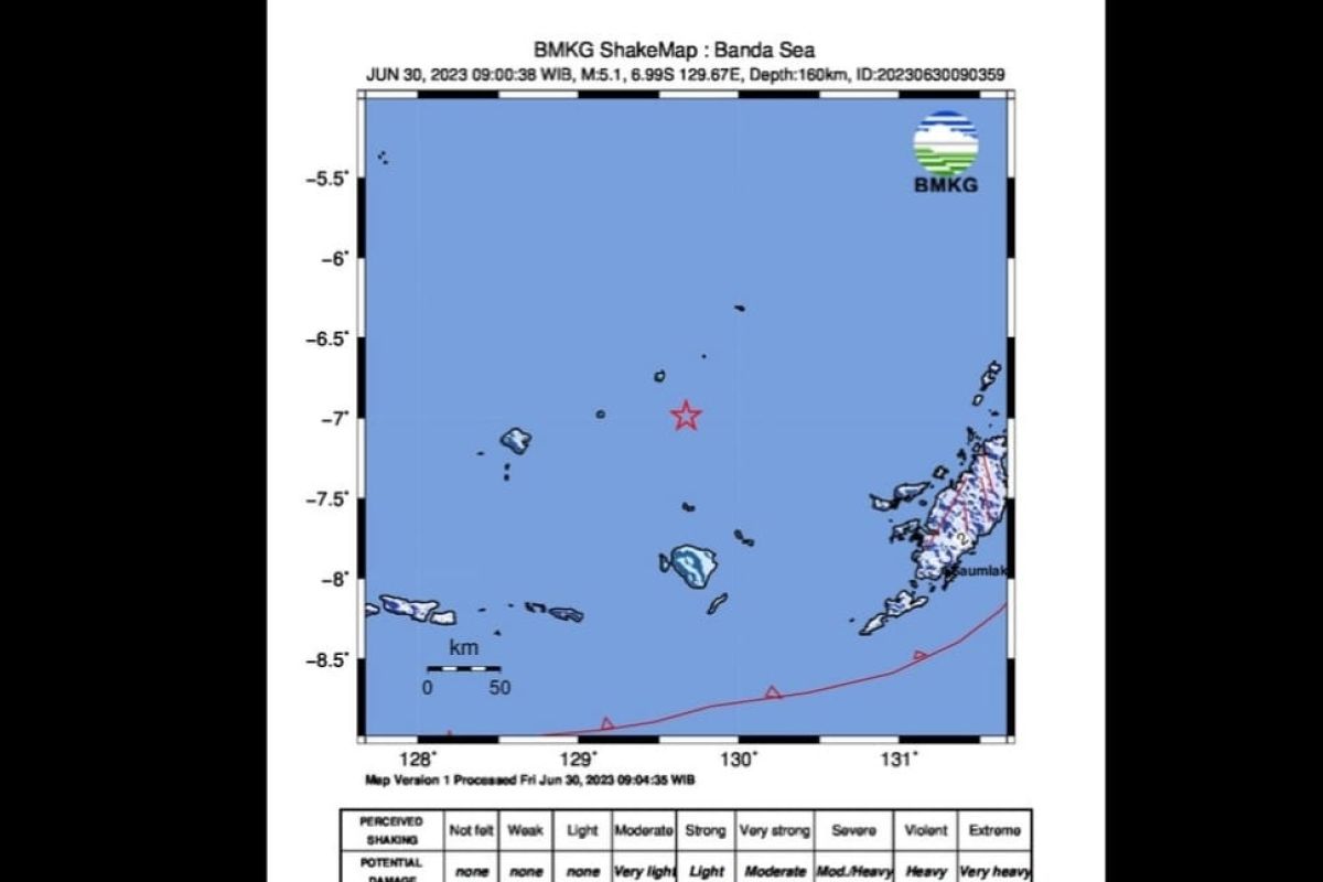
The BMKG initially stated that the earthquake had a magnitude of 5.1 and then updated it to a magnitude of 4.9.
Head of the BMKG Earthquake and Tsunami Center Daryono remarked that the epicenter of the earthquake was located in the sea at a depth of 166 km, at coordinates 6.92 degrees South Latitude and 129.66 degrees East Longitude, some 211 km to the northwest of Tanimbar.
"Taking into account the location of the epicenter and the depth of the hypocenter, this earthquake is a medium-sized earthquake due to subduction activity in the Banda Sea," he remarked.
He said the results of analysis of the source mechanism showed that the earthquake had an upward movement mechanism.
"The modeling results show that this earthquake does not have the potential to cause a tsunami," he remarked.
Related news: Fault causes M6.4 quake in Banda Sea, Maluku: BMKG
Daryono said that the earthquake at Modified Mercalli Intensity (MMI) scale II-III was felt in the Babar Islands.
Shocks on the MMI II scale are felt by several people and cause light objects that are hung to sway, while shocks on the MMI III scale are felt visibly inside the house, with a level of vibration that is felt as though a truck were passing by.
"Until now, there has been no report of the impact of the damage caused by the earthquake," Daryono remarked.
Based on the BMKG monitoring results, he noted that until 9:17 a.m. local time, no aftershock activity had occurred after the earthquake that struck at 09.00 a.m. local time.
However, he advised residents to avoid buildings that were cracked or damaged by the earthquake and to check the condition of residential buildings to ensure there was no damage that could endanger the stability of the building before returning to their homes.
Related news: BMKG records 10,792 earthquakes in Indonesia in 2022
Related news: Minister spotlights importance of intensifying disaster preparedness
Translator: Andi Firdaus, Zubi Mahrofi, Katriana
Editor: Yuni Arisandy Sinaga
Copyright © ANTARA 2023
