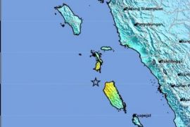
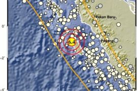
The quake`s epicenter was located 2.59 degrees southern latitude and 99.67 degrees eastern longitude, at a depth of 29 km, around 42 km southeast of Sipora Mentawai, according to information from the Meteorological, Climatology and Geophysics office here on Wednesday.
"The earthquake hitting Mentawai did not have potential to trigger a tsunami," Coordinator of the West Sumatra Disaster Mitigation Agency (BPBD) Ade Edwar said.
However, a number of residents rushed out of their homes in fear of building collapse.
"We are still waiting for reports on the damages caused by the temblor from the Metawai BPBD," he said.
On October 25, 2010, a two-meter tsunami triggered by a magnitude 7.2 earthquake struck the Mentawai islands off the western coast of Sumatra.
A total of 517 houses were destroyed and carried away by the tsunami, while 204 others had minor damage.
The death toll from the last year tsunami in Mentawai was 413, the number of seriously injured people was 270 and that of lightly injured people 140.(*)
Editor: Heru Purwanto
Copyright © ANTARA 2011


