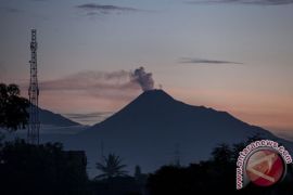
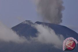
People`s activities must be adjusted to the recommendation and must be confined within itJakarta (ANTARA News) - The status of Mount Slamet located in the districts of Banyumas, Purbalingga, Pemalang, Tegal and Brebes in Central Java has been raised to Alert Level II due to its increasing activity.
"Mount Slamets activity is increasing and so its danger status has been raised to Alert Level II," the spokesman of the National Disaster Mitigation Agency (BNPB), Sutopo Purwo Nugroho, stated here on Wednesday.
He pointed out that there had been 30 earthquake tremors and 67 others caused by smoke coming out of the volcano.
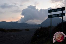
Thick white, brown and grey smoke was also seen billowing up to 150 to 700 meter high.
A total of 26 booms were heard and hot lava was seen flowing down 1.5 thousand meters away from the tip of the mountain.
"In general, the intensity and frequency of Mount Slamets eruption has been increasing," he pointed out.
He added that the government has recommended local governments to evacuate areas within a radius of four kilometers from the peak of the mountain.
"Mountaineering, camping and other tourism activities within the radius are not allowed," he emphasized.
He asserted that people must remain alert and monitor the development of the mountains activity.
He held that the BNPB also called on the people to follow directives recommended by the authorities concerned especially with regard to the danger zone.
"Peoples activities must be adjusted to the recommendation and must be confined within it," he stressed.
He explained that the BNPB kept coordinating with all parties concerned, especially local governments with regard to monitoring the mountains status development.
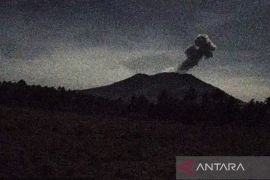
The Geology Disaster Technology Development and Research Center (BPPTKG) of Yogyakarta on Wednesday also raised the status of Mount Merapi (from Normal to Alert Level II), due to increasing volcanic activity.
Head of Yogyakarta BPPTKG Subandriyo explained that the volcano, located at the border between Central Java and Sleman, Yogyakarta, recorded 20 low frequency tremors on Tuesday (April 29), which was predicted as an indication of the increasing volcanic gas flow that had the potential to erupt.
"On the same day, several loud booms were also heard until eight kilometer radius from the Mount Merapi peak," Subandriyo pointed out.
In period between April 20 and 29, there were 37 avalanches, 13 multiphase tremors, four blast or explosions, 24 tectonic tremors, and 29 low frequency tremors at the volcano.
Due to the increased status of the mount, no hiking or climbing will be allowed, except for research or disaster mitigation work.
"We have also asked the residents around Mount Merapi slope not to be provoked by rumors about the volcanos eruption but to follow instruction from the local authority only," he stressed.
There has been no evacuation order from the authority in the current volcanos status.
The BPPTKG of Yogyakarta will intensify the observation on Mount Merapi following its increasing volcanic activity.
The latest major explosion of the most active volcano in Indonesia occurred in 2010.
Over 350 thousand people were evacuated from the affected areas and at least 353 were killed during the eruptions.
(Reporting by Wuryanti Puspitasari/T.W004/H-YH/INE/KR-BSR/A014)
Editor: Priyambodo RH
Copyright © ANTARA 2014
