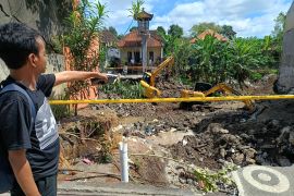
The tremor`s epicenter was located at 0.78 degree latitude and 126.2 degree longitude, some 130 km southwest of Ternate, and at a depth of 30 km, the Meteorology, Climatology and Geophysics Agency (BMKG) reported on its official website.
Earlier, an earthquake measuring 5.0 on the Richter Scale jolted West Maluku Tenggara, Maluku Province, on Tuesday at 11:55 p.m. WIB, but it did not have the potential to trigger a tsunami.
The quake`s epicenter was located at 7.57 degree southern latitude and 130.81 degree eastern longitude, 61 km southwest of West Maluku Tenggara, and at a depth of 83 km.
Indonesia is prone to natural disasters, as the country is located in the Pacific Ring of Fire, where numerous volcanoes and earthquakes occur.
Reporting by Joko Susilo, Fardah Assegaf
Editing by Suharto
Reporter: Antara
Editor: Suharto
Copyright © ANTARA 2019


