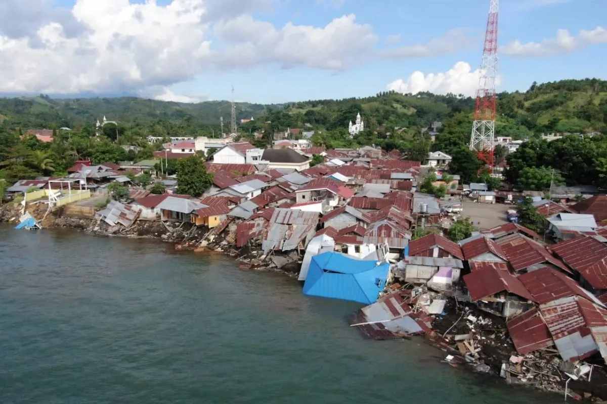
The two currents then moved into the bay and created tremendous forces, which eroded the coastal area.Jakarta (ANTARA) - National Research and Innovation Agency (BRIN) researcher Widodo S. Pranowo on Saturday listed a number of factors that likely caused the recent abrasion on Amurang Boulevard Beach, South Minahasa District, North Sulawesi Province.
In a statement received here on Saturday, he said that the geographical condition of the beach, which directly faces Sulawesi Sea, could have created a bay and caused refraction.
"Refraction is when a wave moving toward the beach undergoes a change in its crest line. Later, the wave moves parallel to the contours of the shoreline," he informed.
Another factor that can have caused the abrasion is the hydrodynamic force generated by two kinds of currents moving around the bay, he said.
The first current generated by tidal waves may have moved toward the northeast of the bay, while the second one produced by wind and ocean waves may have moved toward the west.
"The two currents then moved into the bay and created tremendous forces, which eroded the coastal area," the researcher said.
According to tidal data recorded between 1 p.m. and 5 p.m. Central Indonesian Standard Time (WITA, UTC+8) on June 15, 2022, the sea level elevation at Labuhan Uki Station was observed to be higher compared to Manado Station.
Related news: BRIN builds breakwaters to safeguard coastal areas from abrasion
Theoretically, water flows from a higher elevation to a lower elevation.
Hence, the water mass could have flowed in the northeasterly direction from Labuhan Uki Station to Manado Station, Pranowo said.
"There is a high probability of the water mass entering the bay since it is located between Labuhan Uki and Manado (stations)," he added.
Meanwhile, based on data on wind and ocean waves recorded between 12 p.m. and 2 p.m. Central Indonesia Time (WITA) on June 15, the wind in front of the bay moved toward the west at a speed of 9 to 13 knots and was expected to generate waves reaching a height of 0.6 to 0.8 meters.
"According to the Himawari satellite imagery data, there were also heavy clouds above the bay," the researcher added.
Acting head of the South Minahasa Regional Disaster Mitigation Agency (BPBD), Thorie R. Joseph, had informed in Manado city, North Sulawesi Province, that a bridge, a boulevard road, a beach wall, and several residents' homes along Amurang Beach had collapsed around 2 p.m. WITA on June 15 due to abrasion.
The disaster did not cause any casualties nor injuries, he added.
Related news: BRIN encouraging strengthening of horticultural ecosystem
Translator: Asep Firmansyah, Uyu Liman
Editor: Rahmad Nasution
Copyright © ANTARA 2022


