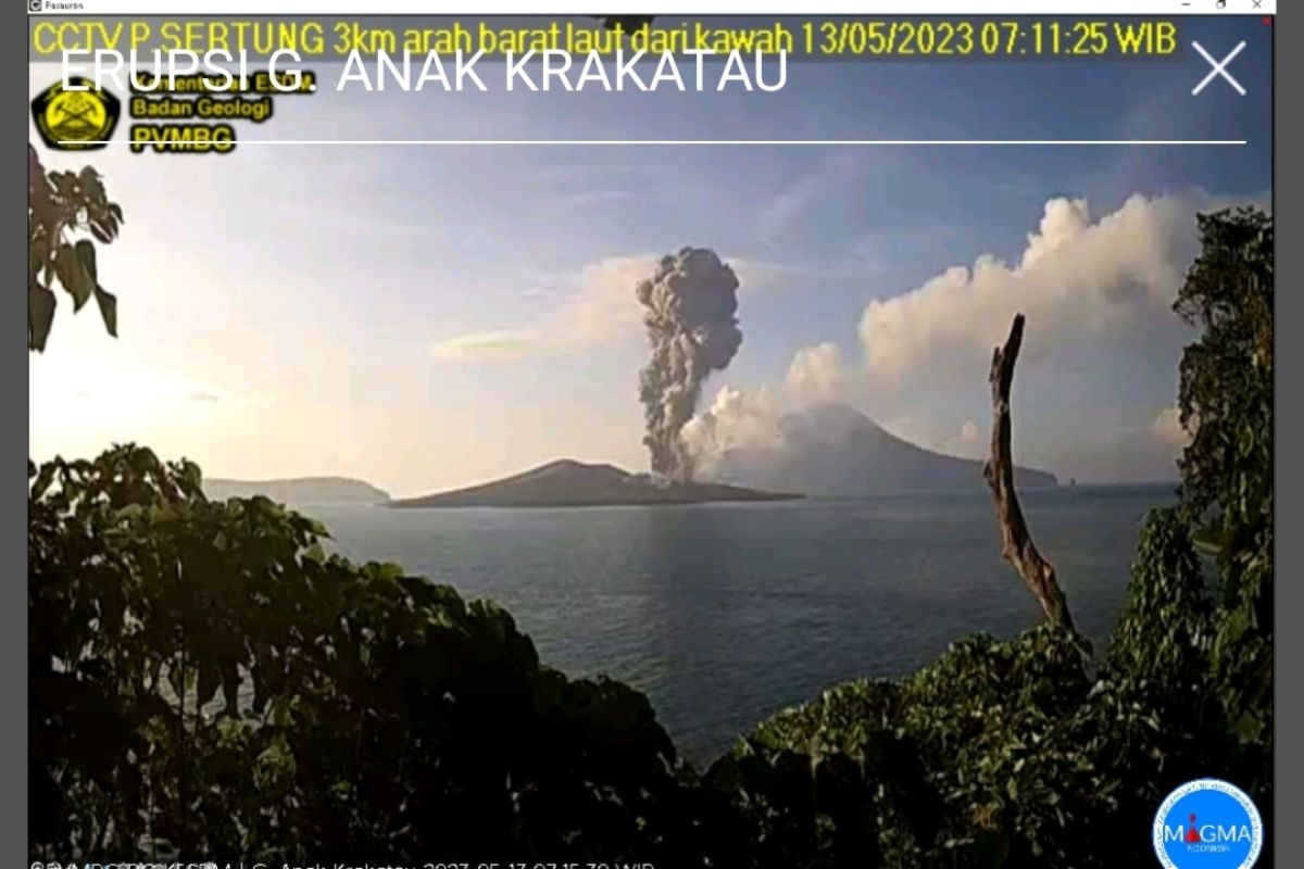
"The ash column was observed to be gray in color, with a thick intensity, leaning towards the southwest," Head of the Mount Anak Krakatau Monitoring Post Andi Suardi stated in Hargopancuran, Rajabasa Sub-district, South Lampung District, Lampung Province.
According to the PVMBG information broadcast, the volcanic eruption located in the waters of Sunda Strait, Lampung Province, was recorded by a seismograph, with a maximum amplitude of 65 mm and a duration of 68 seconds.
When contacted from Kalianda, Suardi stated that the community and fishermen were urged to not approach Mount Anak Krakatau or conduct activities in areas within a five-kilometer radius of the active crater.
"Currently, Mount Anak Krakatau is at level III, or Standby," he remarked.
On Friday (May 12) at 11:20 p.m. local time, Mount Anak Krakatau had also erupted, sending a volcanic ash tower some 1,500 meters above its crater or around 1,657 meters above sea level. The eruption was recorded by a seismograph, with a maximum amplitude of 70 mm and a duration of 86 seconds.
Related news: Mount Anak Krakatau erupts with 2,500-meter-high ash burst: Official
Related news: Mount Anak Krakatau spews ash columns several times on Tuesday
Translator: Riadi Gunawan, Cindy Frishanti Octavia
Editor: Yuni Arisandy Sinaga
Copyright © ANTARA 2023
