BIG head Muh Aris Marfai stated that this target is expected to be achieved in the next four years.
"We believe that Google will use our map data before 2029 because the quality and accuracy are very precise," he remarked after the opening of the agency's national coordination meeting in Jakarta on Thursday.
Marfai stated his belief that this goal is achievable with support from relevant ministries, agencies, local governments, and the community.
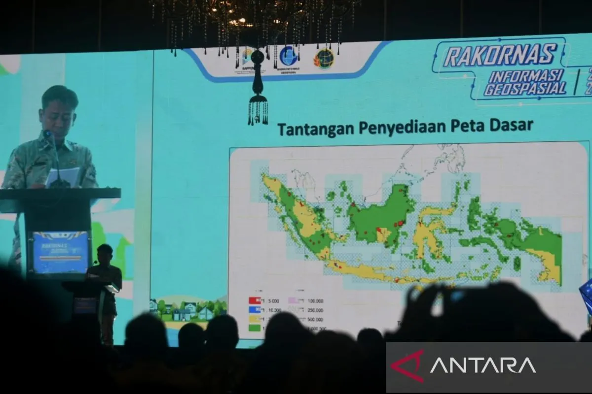
He also highlighted the agency's efforts, including the creation of large-scale (1:250,000) and medium-scale (1:50,000) maps for all of Indonesia, as well as small-scale (1:25,000) maps for Java, Bali, and Nusa Tenggara.
To meet the growing need for detailed maps in areas like investment, research, and disaster mitigation, BIG is innovating by creating highly detailed cadastral maps (scale 1:5,000). While this process began recently, it has already covered 5 percent of Indonesia's territory.
BIG plans to complete mapping all of Sulawesi Island this year, followed by Kalimantan in 2025 and smaller islands by 2028.
Marfai mentioned that the agency receives over Rp800 billion (around US$48.6 million) from the state budget, with additional funding from the World Bank.
Related news: Geospatial agency discovers seamount in Pacitan waters
Related news: BRIN, BIG to cooperate on strengthening geospatial information
Translator: Prasetyo, Kenzu
Editor: Anton Santoso
Copyright © ANTARA 2024


