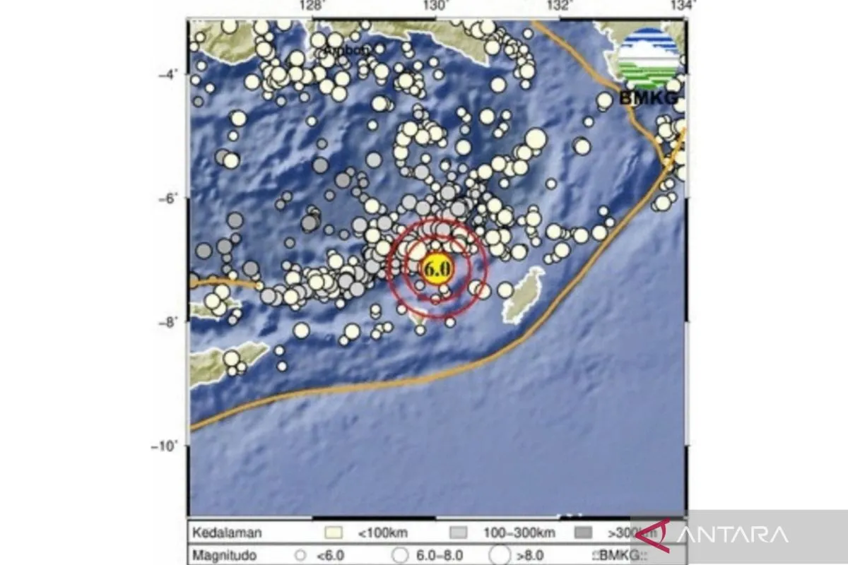
According to the Meteorology, Climatology, and Geophysics Agency (BMKG), the quake's epicenter was located about 170 kilometers southwest of the Tanibar Islands district, at a depth of 153 kilometers.
The quake did not have the potential to trigger a tsunami, but its tremors could be felt as far as Selu and northeast of Southwest Maluku district, the BMKG informed.
Located in the Banda Sea of eastern Indonesia, Tanimbar Islands are famous for World War II veterans who were involved in the Pacific War.
According to the Australian War Memorial's official website, a Royal Australian Air Force aircraft shot down a Japanese plane near Selaru Island of Tanimbar Islands on November 9, 1943.
Earthquakes regularly rock various parts of Indonesia since the country lies on the Circum-Pacific Belt, also known as the Ring of Fire, where several tectonic plates meet and cause frequent volcanic and seismic activities.
Indonesia experienced the deadliest ever earthquake, followed by a tsunami, in Aceh province on December 26, 2004.
The catastrophe, which also affected certain coastal areas in countries such as Thailand, Sri Lanka, and India, reportedly killed around 230 thousand people.
Related news: Magnitude 5.3 earthquake strikes East Java's Malang District
Related news: Garut's 6.5-magnitude earthquake damages 41 houses: BPBD
Related news: Lampung's Tanggamus District shaken by 5.4-magnitude quake
Translator: M.Riezko BEP, Rahmad Nasution
Editor: Azis Kurmala
Copyright © ANTARA 2024


