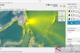
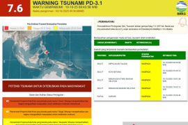
The earthquake's epicenter was located at some 59 kilometers away from north-east of Kota Tanah Merah, the capital of Boven Digoel District, at a depth of 10 kilometers, according to the Jakarta-based Meteorology, Climatology, and Geophysics Agency (BMKG).
Based on its epicenter and depth, it was categorized as a shallow earthquake, caused by a local fault's activities. This tectonic earthquake was caused by an oblique-thrust fault, the agency revealed.
On Feb 26, 2018, a 7.4-magnitude earthquake had rocked the Boven Digoel District areas, causing damage to several buildings, including a mosque in Mindiptana Sub-district.
Related news: Magnitude-6.8 earthquake strikes Morotai, damaging 312 homes: BNPB
Related news: Strong magnitude-6.0 earthquake strikes Indonesia's Banda Sea
Speaking in connection with this earthquake, Head of the BKMG's Center for Earthquake and Tsunami Rahmat Triyono urged locals to stay calm and steer clear of damaged buildings.
Located on the Circum-Pacific Belt, also known as the Ring of Fire, the meeting points of several tectonic plates where frequent volcanic and seismic activities occur, Indonesia is susceptible to natural disasters, including earthquakes and volcanic eruptions.
On June 22, a 5.0-magnitude earthquake hit Pacitan District in East Java Province, but the tremors were felt by not just local residents but also those inhabiting Yogyakarta, Bantul, Sleman, Wonogiri, Tulungagung, and Karangates.
In 2018, the BMKG recorded that Indonesia had borne the impact of 11,577 earthquakes, including several ones causing major casualties, with the figure notably increasing from that in 2017.
The BMKG data indicated that 11,577 earthquakes, with varying magnitudes and depths, hit in 2018, while just 7,172 earthquakes were recorded in 2017.
This indicates that Indonesia had borne witness to a significant spike in the number of tectonic earthquakes in 2018.
Several earthquake-related events that hit Indonesia in 2018, including the liquefaction in Palu, a tsunami that struck prior to the issuance of a tsunami warning in Palu, and the Sunda Strait Tsunami, had occurred for the first.
In 2004, Indonesia had also borne the brunt of a major catastrophe that claimed hundred thousand lives in Banda Aceh and impacted several other parts of Aceh Province after the areas were rattled by a deadly tsunami following a powerful earthquake.
Related news: BNPB assesses damage from 7.1-magnitude quake in North Maluku
Related news: East Java's Pacitan District rattled by 5.0-magnitude quake
Translator: Desi P, Rahmad Nasution
Editor: Sri Haryati
Copyright © ANTARA 2020


