The condition indicates the emergence of La Nina phenomenon since theoretically, the temperature has crossed the limit of 0.5, a condition for La Nina with low intensity to occur.
Currently, during the first 10 days of October, the sea surface temperature at the equatorial Pacific Ocean consistently dropped despite it having already reached minus 0.92. If the temperature touches minus one, La Nina is at the moderate level.
La Nina refers to a phenomenon controlled by a gap in the sea surface temperature between the equatorial Pacific Ocean and the Indonesian water territories, thereby causing the sea surface temperature in Indonesia’s territories to become warmer.
Such a condition causes air pressure that triggers cloud formation, thereby leading to an increase in the rains.
Looking back at the La Nina experience in 2020, the rainfall was 20-70 percent higher than normal in a month.
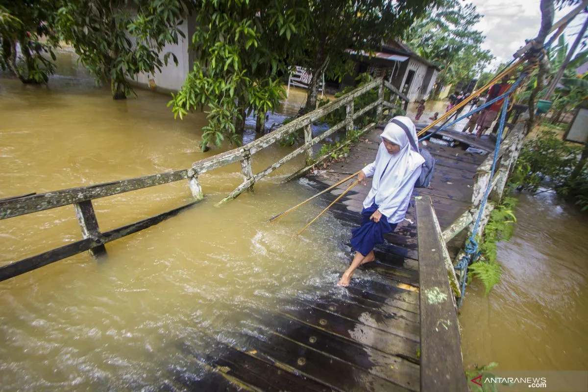
The condition has raised concerns among Indonesian citizens, especially when the country is currently entering the wet season. Hence, they need to stay alert, as hydrometeorological disasters might potentially increase.
The BMKG, along with other international meteorology agencies monitoring the La Nina phenomenon, have forecast that La Nina will have similar impacts as 2020— at low to moderate level— and will last until February 2021.
According to the agency, some 20 percent of season zone (ZOM) areas in Indonesia have entered the wet season by mid-October, though some of them had also experienced the wet season in September.
During La Nina in 2020, rainfall had increased in some parts of Indonesia, particularly in Southern Sumatra, Java, Bali, West Nusa Tenggara (NTB), West Nusa Tenggara (NTT), South Kalimantan, and South Sulawesi.
BMKG Head Dwikorita Karnawati has forecast a consistent increase in rainfall from November 2021 to January 2022. In November, some parts were forecast to receive heavier monthly rainfall from 70 to 100.
Meanwhile, in November 2021, increasing rainfall was predicted to evenly occur in Java, Bali, and NTB. On the other hand, fairly even rainfall has been forecast to occur in NTT and sporadic rains in Sumatra, South Kalimantan, West Kalimantan, South Sulawesi, and North Maluku.
In December 2021, rains will be more intense in Java, Bali, NTB, NTT, North Sumatra, and South Kalimantan and sporadic rains in East Kalimantan and South Sulawesi.
Although those regions were forecast to experience the impacts of La Nina, such as an increase in rainfall, some other regions are reeling from water shortages due to lower rainfall intensity akin to Sumatra and West Kalimantan respectively.
“If in one island, some regions experience lower intensity of rains, while an increase in rains occurs in some other parts, we need to stay alert for forest and land fires,” she highlighted.
In November 2022, La Nina was forecast to have larger impacts in Java, Bali, NTB, and some parts of NTT. Furthermore, its impacts will be sporadic in Sumatra, West Kalimantan, Central Kalimantan, East Kalimantan, and Sulawesi.
Meanwhile, in February 2022, rainfall was forecast to increase in some regions and will get even more higher in Java, Bali, and NTB and of greater intensity in NTT.
Apart from the impacts of La Nina, the public should remain vigilant of tropical storms that often occur from January to February in NTT.
Learn from Experience
During the La Nina in 2020, President Joko Widodo had called on stakeholders to prepare for heavier rainfall in Indonesia due to the climate anomaly phenomenon, with impacts lasting from 2020-end to February 2021.
Based on the National Disaster Mitigation Agency (BNPB), hydrometeorological disasters were forecast to dominantly hit the country from January to April 2021, with floods as the most frequent disaster.
The BNPB recorded as many as 1,205 disasters that struck from January 1, 2021 to April 30, 2021 when hydrometeorological disasters— floods, hurricanes, landslides— were dominant during the period.
Floods were recorded as the most frequent disasters that occurred on 501 instances followed by 339 incidents of hurricane and 233 incidents of landslides.
During the period, the total number of disasters climbed by one percent as compared to the corresponding year. Meanwhile, the death count rose by 1.83 percent.
As a precautionary measure, the BNPB called on the regional disaster mitigation agency (BPBD) in 34 provinces to prepare for the wet hydrometeorological disasters, such as floods, flash floods, landslides, and hurricanes as impacts of La Nina phenomenon.
Early measures that can be taken are intensifying coordination with the BPBD and related stakeholders, conducting regular monitoring of the climate information, weather development, and early warning of extreme weather.
Not only government or apparatuses at sub-district or village levels, but the public should also prepare for such disasters, especially those residing in disaster-prone areas.
BNPB Head Ganip Warsito remarked that the early warnings issued by BMKG became references to be followed up on the field.
“However, there are still missing links between the information on early warnings and the public responses,” he admitted.
The information chains were often broken from the disaster mitigation operation handling center (Pusdalops) that could not be forwarded to the regional administrations and the villages prone to hydrometeorological disasters, Warsito revealed.
In order to address such an issue, BMKG Head Karnawati urged related parties to take precautionary measures once the public cannot receive the information to help handle the La Nina impacts.
The unconnected information chains can hinder public preparedness for handling disasters.
Preparedness in Regions
The populous capital Jakarta almost always experiences floods when high-intensity rains lash for a relatively long period of time, especially on its streets.
Jakarta Governor Anies Baswedan has made assurance of the preparedness of all the provincial administration resources at several operational areas as precautionary measures in facing La Nina.
The governor has already divided the three fronts for handling disasters, with the first being at the sea coasts to handle a rise in sea surface, while second is along the rivers, and the third front is in the downtown, with a different approach applied.
Embankments are prepared for mitigation at the coasts, dams are built along rivers, and clean drainages are prepared in the downtown.
On the other hand, Central Java Governor Ganjar Pranowo has ensured that the staff had received information on early warning.
The disaster-prone area maps are important to be learnt and distributed to the community and related stakeholders, according to Pranowo.
“The public should understand to prepare more for the disasters since Central Java is also categorized as a disaster-prone region, with landslides and tidal floods,” he noted.
The La Nina phenomenon that repeatedly occurs as well as the current climate issues are an eye-opener for Indonesia to boost preparedness and vigilance, so that disasters will not take a toll.
Early warnings, mitigation, and education on climate issues should be disseminated to all parties and become part of the disaster response mechanism.
Related news: Greater challenges ahead in facing disasters: BMKG
Related news: Beware of likely extreme weather in Southern Central Java: BMKG
Related news: BMKG issues flood warning for West Java's 13 districts, cities
Editor: Sri Haryati
Copyright © ANTARA 2021


